Výsledek vyhledávání
61 položek
Upřesnit výsledky vyhledávání
instituce
materiál
geografie (původ)
-
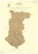
 Mapová sbírka Přírodovědecké fakulty UK v PrazeCook district 2 mile sketch map
 -
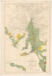
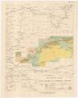
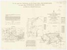
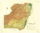
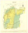
 Mapová sbírka Přírodovědecké fakulty UK v PrazeTopographical map of Hills district between Adelaide & the Bremer Ranges
 -
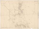
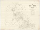
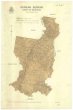
 Mapová sbírka Přírodovědecké fakulty UK v PrazeMap of M.t Kosciusko & surrounding districts
 -
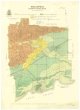
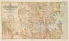 Mapová sbírka Přírodovědecké fakulty UK v PrazeMap of Sydney harbour and surrounding districts, New South Wales
 -
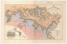
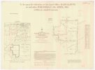
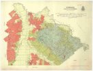
 Mapová sbírka Přírodovědecké fakulty UK v PrazeMap of the southern portion of South Australia
 -
 Mapová sbírka Přírodovědecké fakulty UK v PrazeThe Blue Mountains
 -
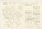
 Mapová sbírka Přírodovědecké fakulty UK v PrazePlan of country between River Murray and Pinnaroo railway
 -
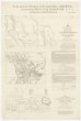
 Mapová sbírka Přírodovědecké fakulty UK v PrazeTourists sketch map
 -
 Mapová sbírka Přírodovědecké fakulty UK v PrazeParish of Herberton, county of Cardwell
 -
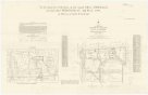
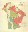
 Mapová sbírka Přírodovědecké fakulty UK v PrazeSketch map of portions 6 to 13 & 15 to 32 parish of Greenup, portions 8 to 11 parish of Plassey and portions 174 to 177 parish of Coolmunda countries of Clive & Bentinck
 -
 Mapová sbírka Přírodovědecké fakulty UK v PrazePlan of portions 3 & 4 parish of Blairgowrie Charlotte Plains 1/4 resumption and portion 2 parish of Bellanda Telemon 1/4 resumption, county of Dutton
 -
 Mapová sbírka Přírodovědecké fakulty UK v PrazePlan of portions 8 to 11 parish of Avington, Avington resumption, county of Youranigh
 -
 Mapová sbírka Přírodovědecké fakulty UK v PrazeSketch map of portions 57 & 58 parish of Tinaroo, county of Nares
 -
 Mapová sbírka Přírodovědecké fakulty UK v PrazePlan of portions 5 & 6 parish of Malden, county of Beaufort
 -
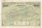
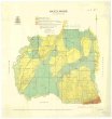
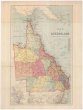 Mapová sbírka Přírodovědecké fakulty UK v PrazeMap of Queensland
 -
 Mapová sbírka Přírodovědecké fakulty UK v PrazeColac Colac
 -
 Mapová sbírka Přírodovědecké fakulty UK v PrazeWelshpool
 -
 Mapová sbírka Přírodovědecké fakulty UK v PrazeNarracan South
 -
 Mapová sbírka Přírodovědecké fakulty UK v PrazeTowong
 -
 Mapová sbírka Přírodovědecké fakulty UK v PrazeHazelwood
 -
 Mapová sbírka Přírodovědecké fakulty UK v PrazeDevon
 -
 Mapová sbírka Přírodovědecké fakulty UK v PrazeMaryvale
 -
 Mapová sbírka Přírodovědecké fakulty UK v PrazeGunyah Gunyah
 -
 Mapová sbírka Přírodovědecké fakulty UK v PrazeWonyip