-
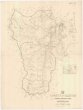
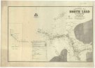 Mapová sbírka Přírodovědecké fakulty UK v PrazeGeological map of the North Lead Kanowna
 -
 Mapová sbírka Přírodovědecké fakulty UK v PrazeGeological map of portion of the Southern coal field
 -
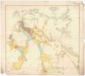
 Mapová sbírka Přírodovědecké fakulty UK v PrazeGeological map of South Australia
 -
 Mapová sbírka Přírodovědecké fakulty UK v PrazeGeological map of the Northern Territory of South Australia
 -
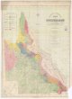
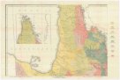 Mapová sbírka Přírodovědecké fakulty UK v PrazeGeological map of Queensland
 -
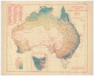
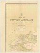 Mapová sbírka Přírodovědecké fakulty UK v PrazeMap of Western Australia
 -
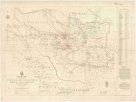
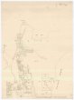
 Mapová sbírka Přírodovědecké fakulty UK v PrazeTopographical plan of the National Park Hd. of Adelaide
 -
 Mapová sbírka Přírodovědecké fakulty UK v PrazeMap of Queensland
 -
 Mapová sbírka Přírodovědecké fakulty UK v PrazeMean monthly temperature
 -
 Mapová sbírka Přírodovědecké fakulty UK v PrazeMean monthly rainfall
 -
 Mapová sbírka Přírodovědecké fakulty UK v PrazeRevised average annual rainfall map
 -
 Mapová sbírka Přírodovědecké fakulty UK v PrazeAverage yearly temperature
 -
 Mapová sbírka Přírodovědecké fakulty UK v PrazeCopper mining district of Cloncurry, north western Queensland
 -
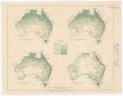
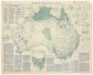
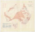
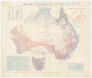
 Mapová sbírka Přírodovědecké fakulty UK v PrazeAverage annual rainfall map of Australia
 -
 Mapová sbírka Přírodovědecké fakulty UK v PrazeCounty of Livingstone
 -
 Mapová sbírka Přírodovědecké fakulty UK v PrazeRain map of Australia for the year 1922
 -
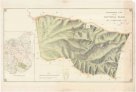
 Mapová sbírka Přírodovědecké fakulty UK v PrazeParish of Bellender Ker, County of Nares
 -
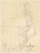
 Mapová sbírka Přírodovědecké fakulty UK v PrazePlan of River Murray between Morgan and province boundary
 -
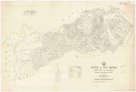
 Mapová sbírka Přírodovědecké fakulty UK v PrazeSketch map of the Etheridge goldfield
 -
 Mapová sbírka Přírodovědecké fakulty UK v PrazeParish of East Barron, County of Nares
 -
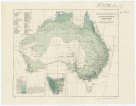
 Mapová sbírka Přírodovědecké fakulty UK v PrazeRainfall of Australia
 -
 Mapová sbírka Přírodovědecké fakulty UK v PrazeCounty of Clinton
 -
 Mapová sbírka Přírodovědecké fakulty UK v PrazeRain map of Australia for the year 1909
 -
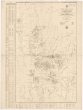
 Mapová sbírka Přírodovědecké fakulty UK v PrazeEnvirons of Cairns