Mapová sbírka je univerzitní sbírkou pro vědu, výzkum a výuku. Slouží akademickým pracovníkům a studentům Univerzity Karlovy, ale i ostatní odborné a laické veřejnosti. Sbírka obsahuje podle poslední revize z roku 1980 kolem 130 000 map, 3000 atlasů a 80 globů. Přibližně polovinu této sbírky tvoří staré tisky. Svým rozsahem i obsahem je unikátní univerzitní sbírkou v celé Střední Evropě. Podobné univerzitní sbírky se nacházejí až v Paříži nebo v Oslu.
Obsahuje nejvýznamnější díla významných kartografů domácích, např. Klaudyána, Crigingera, Aretina, Podolského, Komenského, Hollara, Vogta, Müllera, Helwiga. Výpravné sběratelské a tematické atlasy (historické, astronomické, vojenské, atd.), atlasy kartografických mistrů a umělců jako byli Mercator, Ortelius, de Jode, Hondius, nebo Janzoon jež vystupoval pod pseudonymem Willem Blaeu. Sbírka má též cenné globy od 17. století. Nejstarší datovaná díla pocházejí z 16. století. Ve sbírce byly také objeveny originální rukopisy 3. vojenského mapování v měřítku 1:25 000.
Díky projektu TEMAP (2011-2015) získala sbírka finanční prostředky na zaměstnance pro odbornou katalogizaci a digitalizaci. Zároveň probíhalo, čištění, balení, stěhování a přesignování fondu.
-
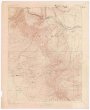
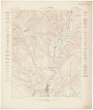
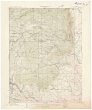
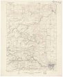
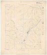
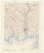
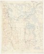
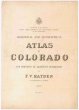
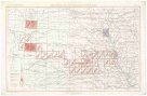
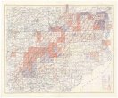
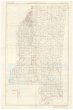
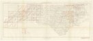
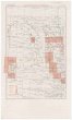
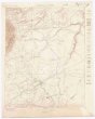 Mapová sbírka Přírodovědecké fakulty UK v PrazeColorado
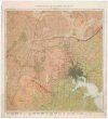
 -
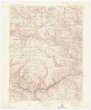
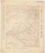
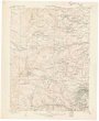
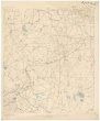
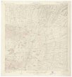
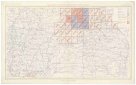
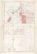
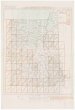
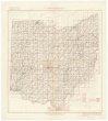
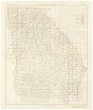
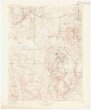 Mapová sbírka Přírodovědecké fakulty UK v PrazeColorado
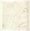
 -
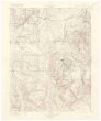
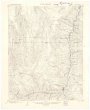
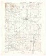
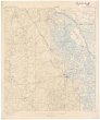
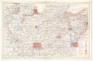
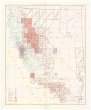
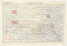
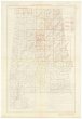
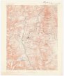 Mapová sbírka Přírodovědecké fakulty UK v PrazeColorado
 -
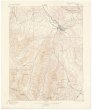
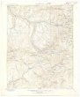
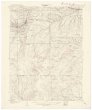
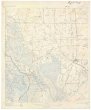
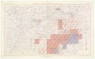
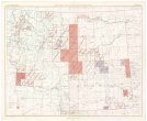
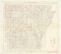
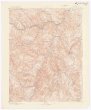 Mapová sbírka Přírodovědecké fakulty UK v PrazeColorado
 -
 Mapová sbírka Přírodovědecké fakulty UK v PrazeColorado
 -
 Mapová sbírka Přírodovědecké fakulty UK v PrazeColorado
 -
 Mapová sbírka Přírodovědecké fakulty UK v PrazeColorado
 -
 Mapová sbírka Přírodovědecké fakulty UK v PrazeColorado
 -
 Mapová sbírka Přírodovědecké fakulty UK v PrazeColorado
 -
 Mapová sbírka Přírodovědecké fakulty UK v PrazeColorado
 -
 Mapová sbírka Přírodovědecké fakulty UK v PrazeColorado
 -
 Mapová sbírka Přírodovědecké fakulty UK v PrazeColorado
 -
 Mapová sbírka Přírodovědecké fakulty UK v PrazeColorado
 -
 Mapová sbírka Přírodovědecké fakulty UK v PrazeColorado
 -
 Mapová sbírka Přírodovědecké fakulty UK v PrazeColorado
 -
 Mapová sbírka Přírodovědecké fakulty UK v PrazeColorado
 -
 Mapová sbírka Přírodovědecké fakulty UK v PrazeColorado
 -
 Mapová sbírka Přírodovědecké fakulty UK v PrazeColorado
 -
 Mapová sbírka Přírodovědecké fakulty UK v PrazeColorado
 -
 Mapová sbírka Přírodovědecké fakulty UK v PrazeColorado
 -
 Mapová sbírka Přírodovědecké fakulty UK v PrazeColorado
 -
 Mapová sbírka Přírodovědecké fakulty UK v PrazeColorado
 -
 Mapová sbírka Přírodovědecké fakulty UK v PrazeColorado
 -
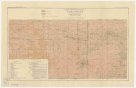
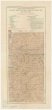
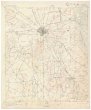
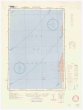
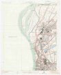
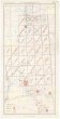
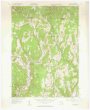 Mapová sbírka Přírodovědecké fakulty UK v PrazeColrain quadrangle
 -
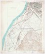
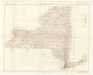
 Mapová sbírka Přírodovědecké fakulty UK v PrazeConn. - R.I. - N.Y.
 -
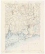
 Mapová sbírka Přírodovědecké fakulty UK v PrazeConnecticut - New York
 -
 Mapová sbírka Přírodovědecké fakulty UK v PrazeCuba sheet of the lead and zinc district
 -
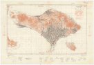 Mapová sbírka Přírodovědecké fakulty UK v PrazeEast Indies 1:200 000
 -
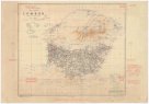 Mapová sbírka Přírodovědecké fakulty UK v PrazeEast Indies 1:200 000
 -
 Mapová sbírka Přírodovědecké fakulty UK v PrazeEast Meekers Grove sheet of the lead and zinc district
 -
 Mapová sbírka Přírodovědecké fakulty UK v PrazeEast Mineral Point sheet of the lead and zinc district
 -
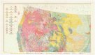
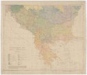 Mapová sbírka Přírodovědecké fakulty UK v PrazeEthnographic map of the Balkan Peninsula
 -
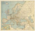 Mapová sbírka Přírodovědecké fakulty UK v PrazeEurope and the Mediterranean
 -
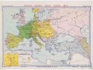 Mapová sbírka Přírodovědecké fakulty UK v PrazeEurope at the time of Napoleon.
 -
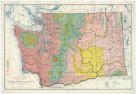 Mapová sbírka Přírodovědecké fakulty UK v PrazeFloral areas of the state of Washington
 -
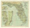
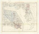
 Mapová sbírka Přírodovědecké fakulty UK v PrazeFlorida
 -
 Mapová sbírka Přírodovědecké fakulty UK v PrazeFlorida
 -
 Mapová sbírka Přírodovědecké fakulty UK v PrazeFlorida
 -
 Mapová sbírka Přírodovědecké fakulty UK v PrazeFlorida
 -
 Mapová sbírka Přírodovědecké fakulty UK v PrazeFlorida
 -
 Mapová sbírka Přírodovědecké fakulty UK v PrazeFlorida
 -
 Mapová sbírka Přírodovědecké fakulty UK v PrazeFlorida
 -
 Mapová sbírka Přírodovědecké fakulty UK v PrazeFlorida
 -
 Mapová sbírka Přírodovědecké fakulty UK v PrazeGeologic map of the United States
 -
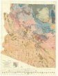 Mapová sbírka Přírodovědecké fakulty UK v PrazeGeologic map of the state of Arizona
 -
 Mapová sbírka Přírodovědecké fakulty UK v PrazeGeological Map of the Lake Superior land district in the state of Michigan
 -
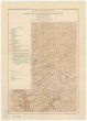
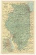
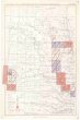
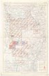
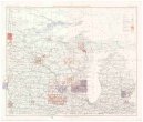
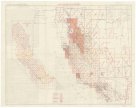
 Mapová sbírka Přírodovědecké fakulty UK v PrazeGeological and geographical atlas of Colorado and portions of adjacent territory
 -
 Mapová sbírka Přírodovědecké fakulty UK v PrazeGeological map of Baltimore and vicinity
 -
 Mapová sbírka Přírodovědecké fakulty UK v PrazeHawaii
 -
 Mapová sbírka Přírodovědecké fakulty UK v PrazeHawaii
 -
 Mapová sbírka Přírodovědecké fakulty UK v PrazeHonto
 -
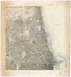
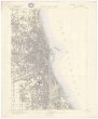
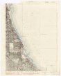
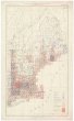
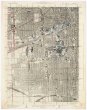 Mapová sbírka Přírodovědecké fakulty UK v PrazeIllinois
 -
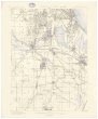
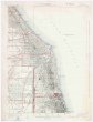 Mapová sbírka Přírodovědecké fakulty UK v PrazeIllinois
 -
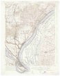
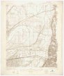 Mapová sbírka Přírodovědecké fakulty UK v PrazeIllinois
 -
 Mapová sbírka Přírodovědecké fakulty UK v PrazeIllinois
 -
 Mapová sbírka Přírodovědecké fakulty UK v PrazeIllinois
 -
 Mapová sbírka Přírodovědecké fakulty UK v PrazeIllinois
 -
 Mapová sbírka Přírodovědecké fakulty UK v PrazeIllinois
 -
 Mapová sbírka Přírodovědecké fakulty UK v PrazeIllinois
 -
 Mapová sbírka Přírodovědecké fakulty UK v PrazeIllinois - Indiana
 -
 Mapová sbírka Přírodovědecké fakulty UK v PrazeIllinois - Indiana
 -
 Mapová sbírka Přírodovědecké fakulty UK v PrazeIllinois - Kentucky - Missouri
 -
 Mapová sbírka Přírodovědecké fakulty UK v PrazeIllinois - Missouri
 -
 Mapová sbírka Přírodovědecké fakulty UK v PrazeIllinois - Missouri
 -
 Mapová sbírka Přírodovědecké fakulty UK v PrazeIndex to atlas sheet
 -
 Mapová sbírka Přírodovědecké fakulty UK v PrazeIndex to atlas sheet
 -
 Mapová sbírka Přírodovědecké fakulty UK v PrazeIndex to atlas sheet
 -
 Mapová sbírka Přírodovědecké fakulty UK v PrazeIndex to atlas sheet
 -
 Mapová sbírka Přírodovědecké fakulty UK v PrazeIndex to atlas sheet
 -
 Mapová sbírka Přírodovědecké fakulty UK v PrazeIndex to atlas sheet
 -
 Mapová sbírka Přírodovědecké fakulty UK v PrazeIndex to atlas sheet
 -
 Mapová sbírka Přírodovědecké fakulty UK v PrazeIndex to atlas sheet
 -
 Mapová sbírka Přírodovědecké fakulty UK v PrazeIndex to atlas sheet
 -
 Mapová sbírka Přírodovědecké fakulty UK v PrazeIndex to atlas sheet
 -
 Mapová sbírka Přírodovědecké fakulty UK v PrazeIndex to atlas sheet
 -
 Mapová sbírka Přírodovědecké fakulty UK v PrazeIndex to atlas sheet
 -
 Mapová sbírka Přírodovědecké fakulty UK v PrazeIndex to atlas sheet
 -
 Mapová sbírka Přírodovědecké fakulty UK v PrazeIndex to atlas sheet
 -
 Mapová sbírka Přírodovědecké fakulty UK v PrazeIndex to maps of the old geographic series
 -
 Mapová sbírka Přírodovědecké fakulty UK v PrazeIndex to topographic maps
 -
 Mapová sbírka Přírodovědecké fakulty UK v PrazeIndex to topographic maps and geologic folios
 -
 Mapová sbírka Přírodovědecké fakulty UK v PrazeIndex to topographic maps and geologic folios
 -
 Mapová sbírka Přírodovědecké fakulty UK v PrazeIndex to topographic maps and geologic folios
 -
 Mapová sbírka Přírodovědecké fakulty UK v PrazeIndex to topographic maps and geologic folios
 -
 Mapová sbírka Přírodovědecké fakulty UK v PrazeIndex to topographic maps and geologic folios
 -
 Mapová sbírka Přírodovědecké fakulty UK v PrazeIndex to topographic maps and geologic folios
 -
 Mapová sbírka Přírodovědecké fakulty UK v PrazeIndex to topographic maps and geologic folios
 -
 Mapová sbírka Přírodovědecké fakulty UK v PrazeIndex to topographic maps and geologic folios
 -
 Mapová sbírka Přírodovědecké fakulty UK v PrazeIndex to topographic maps and geologic folios
 -
 Mapová sbírka Přírodovědecké fakulty UK v PrazeIndex to topographic maps and geologic folios
 -
 Mapová sbírka Přírodovědecké fakulty UK v PrazeIndex to topographic maps and geologic folios
 -
 Mapová sbírka Přírodovědecké fakulty UK v PrazeIndex to topographic maps and geologic folios
 -
 Mapová sbírka Přírodovědecké fakulty UK v PrazeIndex to topographic maps and geologic folios
 -
 Mapová sbírka Přírodovědecké fakulty UK v PrazeIndex to topographic maps and geologic folios
 -
 Mapová sbírka Přírodovědecké fakulty UK v PrazeIndex to topographic maps and geologic folios
 -
 Mapová sbírka Přírodovědecké fakulty UK v PrazeIndex to topographic maps and geologic folios