-
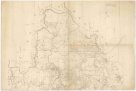
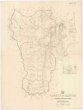
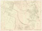
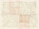 Mapová sbírka Přírodovědecké fakulty UK v PrazeQueensland four mile maps
 -
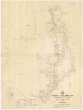
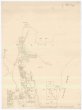
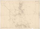
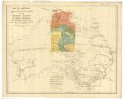 Mapová sbírka Přírodovědecké fakulty UK v PrazeMap of Australia
 -
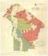
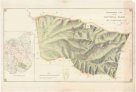
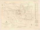
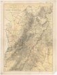
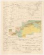
 Mapová sbírka Přírodovědecké fakulty UK v PrazeGeological map of Coolgardie
 -
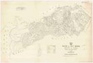
 Mapová sbírka Přírodovědecké fakulty UK v PrazeColac Colac
 -
 Mapová sbírka Přírodovědecké fakulty UK v PrazeWelshpool
 -
 Mapová sbírka Přírodovědecké fakulty UK v PrazeNarracan South
 -
 Mapová sbírka Přírodovědecké fakulty UK v PrazeTowong
 -
 Mapová sbírka Přírodovědecké fakulty UK v PrazeHazelwood
 -
 Mapová sbírka Přírodovědecké fakulty UK v PrazeDevon
 -
 Mapová sbírka Přírodovědecké fakulty UK v PrazeMaryvale
 -
 Mapová sbírka Přírodovědecké fakulty UK v PrazeGunyah Gunyah
 -
 Mapová sbírka Přírodovědecké fakulty UK v PrazeWonyip
 -
 Mapová sbírka Přírodovědecké fakulty UK v PrazeBinginwarri
 -
 Mapová sbírka Přírodovědecké fakulty UK v PrazeMirboo
 -
 Mapová sbírka Přírodovědecké fakulty UK v PrazeThowgla and part of Kangobin
 -
 Mapová sbírka Přírodovědecké fakulty UK v PrazeTarwin South
 -
 Mapová sbírka Přírodovědecké fakulty UK v PrazeBudgerre
 -
 Mapová sbírka Přírodovědecké fakulty UK v PrazeAdjie and portion of Welumla
 -
 Mapová sbírka Přírodovědecké fakulty UK v PrazeNarracan
 -
 Mapová sbírka Přírodovědecké fakulty UK v PrazeWaratah North
 -
 Mapová sbírka Přírodovědecké fakulty UK v PrazeMeeniyan
 -
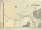 Mapová sbírka Přírodovědecké fakulty UK v PrazeGeological map of the North Lead Kanowna
 -
 Mapová sbírka Přírodovědecké fakulty UK v PrazeGeological map of portion of the Southern coal field
 -
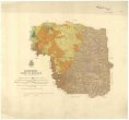
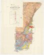
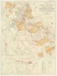
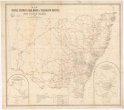
 Mapová sbírka Přírodovědecké fakulty UK v PrazeGeological map of South Australia
 -
 Mapová sbírka Přírodovědecké fakulty UK v PrazeGeological map of the Northern Territory of South Australia
 -
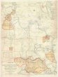
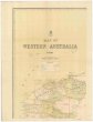 Mapová sbírka Přírodovědecké fakulty UK v PrazeMap of Western Australia
 -
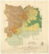
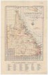
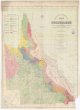 Mapová sbírka Přírodovědecké fakulty UK v PrazeMap of Queensland
 -
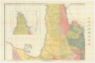 Mapová sbírka Přírodovědecké fakulty UK v PrazeGeological map of Queensland
 -
 Mapová sbírka Přírodovědecké fakulty UK v PrazeTopographical plan of the National Park Hd. of Adelaide
 -
 Mapová sbírka Přírodovědecké fakulty UK v PrazeCopper mining district of Cloncurry, north western Queensland
 -
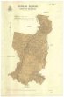
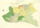
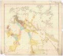
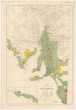
 Mapová sbírka Přírodovědecké fakulty UK v PrazeCounty of Livingstone
 -
 Mapová sbírka Přírodovědecké fakulty UK v PrazeParish of Bellender Ker, County of Nares
 -
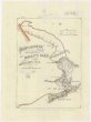
 Mapová sbírka Přírodovědecké fakulty UK v PrazeSketch map of the Etheridge goldfield
 -
 Mapová sbírka Přírodovědecké fakulty UK v PrazeParish of East Barron, County of Nares
 -
 Mapová sbírka Přírodovědecké fakulty UK v PrazeCounty of Clinton
 -
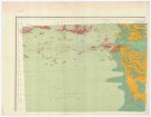
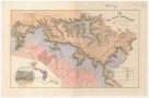
 Mapová sbírka Přírodovědecké fakulty UK v PrazeEnvirons of Cairns
 -
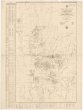
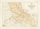
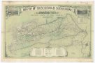
![[Western Australia]](/data/cache/media/15/12478221-136x110-1707334382.jpg) Mapová sbírka Přírodovědecké fakulty UK v Praze[Western Australia]
Mapová sbírka Přírodovědecké fakulty UK v Praze[Western Australia] -
 Mapová sbírka Přírodovědecké fakulty UK v PrazeSketch map of Cape York peninsula
 -
 Mapová sbírka Přírodovědecké fakulty UK v PrazeSketch map of east central Queensland
 -
 Mapová sbírka Přírodovědecké fakulty UK v PrazeSketch map of goldfields in the vicinity of Charters Towers
 -
 Mapová sbírka Přírodovědecké fakulty UK v PrazeSketch map of the Croydon & Etheridge goldfields
 -
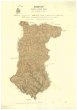
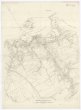
 Mapová sbírka Přírodovědecké fakulty UK v PrazeCounty of Nares
 -
 Mapová sbírka Přírodovědecké fakulty UK v PrazeMap of county of Fitzroy
 -
 Mapová sbírka Přírodovědecké fakulty UK v PrazeCook 2 mile map
 -
 Mapová sbírka Přírodovědecké fakulty UK v PrazeCook district 2 mile sketch map
 -
 Mapová sbírka Přírodovědecké fakulty UK v PrazeMap of the north eastern tourist district
 -
 Mapová sbírka Přírodovědecké fakulty UK v PrazeTopographical map of Hills district between Adelaide & the Bremer Ranges
 -
 Mapová sbírka Přírodovědecké fakulty UK v PrazeMap of M.t Kosciusko & surrounding districts
 -
 Mapová sbírka Přírodovědecké fakulty UK v PrazeMap of Sydney harbour and surrounding districts, New South Wales
 -
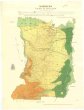
 Mapová sbírka Přírodovědecké fakulty UK v PrazeMap of the southern portion of South Australia
 -
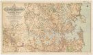
 Mapová sbírka Přírodovědecké fakulty UK v PrazeQueensland
 -
 Mapová sbírka Přírodovědecké fakulty UK v PrazeThe Blue Mountains
 -
 Mapová sbírka Přírodovědecké fakulty UK v PrazePlan of country between River Murray and Pinnaroo railway
 -
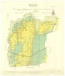
 Mapová sbírka Přírodovědecké fakulty UK v PrazeMap of New South Wales
 -
 Mapová sbírka Přírodovědecké fakulty UK v PrazeMap shewing the postal stations, mail roads & telegraph offices in New South Wales, 1898
 -
 Mapová sbírka Přírodovědecké fakulty UK v PrazeTourists sketch map
 -
 Mapová sbírka Přírodovědecké fakulty UK v PrazeKennedy 2-mile map
 -
 Mapová sbírka Přírodovědecké fakulty UK v PrazeMoreton 2 mile map
 -
 Mapová sbírka Přírodovědecké fakulty UK v PrazeParish of Herberton, county of Cardwell
 -
 Mapová sbírka Přírodovědecké fakulty UK v PrazeParish of Danbulla, county of Nares