-
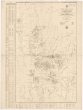
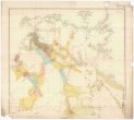
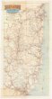
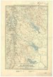
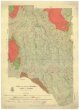 Mapová sbírka Přírodovědecké fakulty UK v PrazeAdjie and portion of Welumla
 -
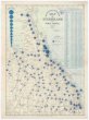
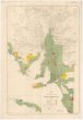
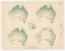
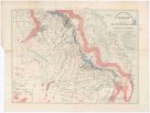 Mapová sbírka Přírodovědecké fakulty UK v PrazeApproximate iso-potential lines of artesian pressure
 -
 Mapová sbírka Přírodovědecké fakulty UK v PrazeAverage annual rainfall map of Australia
 -
 Mapová sbírka Přírodovědecké fakulty UK v PrazeAverage yearly temperature
 -
 Mapová sbírka Přírodovědecké fakulty UK v PrazeBinginwarri
 -
 Mapová sbírka Přírodovědecké fakulty UK v PrazeBudgerre
 -
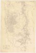
 Mapová sbírka Přírodovědecké fakulty UK v PrazeColac Colac
 -
 Mapová sbírka Přírodovědecké fakulty UK v PrazeCook 2 mile map
 -
 Mapová sbírka Přírodovědecké fakulty UK v PrazeCook district 2 mile sketch map
 -
 Mapová sbírka Přírodovědecké fakulty UK v PrazeCopper mining district of Cloncurry, north western Queensland
 -
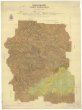
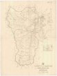 Mapová sbírka Přírodovědecké fakulty UK v PrazeCounty of Clinton
 -
 Mapová sbírka Přírodovědecké fakulty UK v PrazeCounty of Livingstone
 -
 Mapová sbírka Přírodovědecké fakulty UK v PrazeCounty of Nares
 -
 Mapová sbírka Přírodovědecké fakulty UK v PrazeDevon
 -
 Mapová sbírka Přírodovědecké fakulty UK v PrazeEnvirons of Cairns
 -
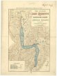
 Mapová sbírka Přírodovědecké fakulty UK v PrazeGeneral plan of Brisbane River
 -
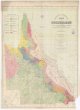
 Mapová sbírka Přírodovědecké fakulty UK v PrazeGeological map of Coolgardie
 -
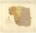
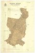
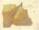
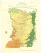
 Mapová sbírka Přírodovědecké fakulty UK v PrazeGeological map of Queensland
 -
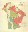
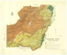
 Mapová sbírka Přírodovědecké fakulty UK v PrazeGeological map of South Australia
 -
 Mapová sbírka Přírodovědecké fakulty UK v PrazeGeological map of portion of the Southern coal field
 -
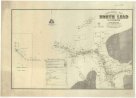 Mapová sbírka Přírodovědecké fakulty UK v PrazeGeological map of the North Lead Kanowna
 -
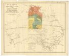
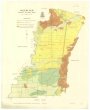
 Mapová sbírka Přírodovědecké fakulty UK v PrazeGeological map of the Northern Territory of South Australia
 -
 Mapová sbírka Přírodovědecké fakulty UK v PrazeGunyah Gunyah
 -
 Mapová sbírka Přírodovědecké fakulty UK v PrazeHazelwood
 -
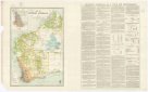
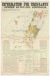 Mapová sbírka Přírodovědecké fakulty UK v PrazeInformation for emigrants to Sydney, New South Wales, Australia
 -
 Mapová sbírka Přírodovědecké fakulty UK v PrazeKennedy 2-mile map
 -
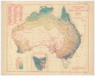
 Mapová sbírka Přírodovědecké fakulty UK v PrazeMap of Australia
 -
 Mapová sbírka Přírodovědecké fakulty UK v PrazeMap of M.t Kosciusko & surrounding districts
 -
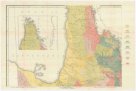
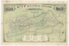
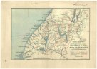
 Mapová sbírka Přírodovědecké fakulty UK v PrazeMap of New South Wales
 -
 Mapová sbírka Přírodovědecké fakulty UK v PrazeMap of New Zealand
 -
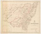
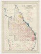
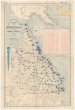
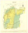
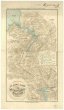
 Mapová sbírka Přírodovědecké fakulty UK v PrazeMap of Queensland
 -
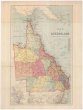
 Mapová sbírka Přírodovědecké fakulty UK v PrazeMap of Queensland
 -
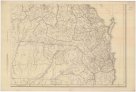
 Mapová sbírka Přírodovědecké fakulty UK v PrazeMap of Queensland
 -
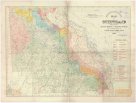
 Mapová sbírka Přírodovědecké fakulty UK v PrazeMap of Queensland
 -
 Mapová sbírka Přírodovědecké fakulty UK v PrazeMap of Queensland
 -
 Mapová sbírka Přírodovědecké fakulty UK v PrazeMap of Queensland showing annual rainfall to end of 1899
 -
 Mapová sbírka Přírodovědecké fakulty UK v PrazeMap of Queensland showing annual rainfall to end of 1906
 -
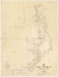
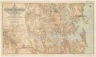 Mapová sbírka Přírodovědecké fakulty UK v PrazeMap of Sydney harbour and surrounding districts, New South Wales
 -
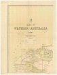 Mapová sbírka Přírodovědecké fakulty UK v PrazeMap of Western Australia
 -
 Mapová sbírka Přírodovědecké fakulty UK v PrazeMap of Western Australia, 1904
 -
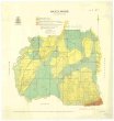
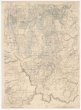
 Mapová sbírka Přírodovědecké fakulty UK v PrazeMap of county of Fitzroy
 -
 Mapová sbírka Přírodovědecké fakulty UK v PrazeMap of east & west Moreton
 -
 Mapová sbírka Přírodovědecké fakulty UK v PrazeMap of the North Island, New Zealand
 -
 Mapová sbírka Přírodovědecké fakulty UK v PrazeMap of the north eastern tourist district
 -
 Mapová sbírka Přírodovědecké fakulty UK v PrazeMap of the southern portion of South Australia
 -
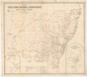 Mapová sbírka Přírodovědecké fakulty UK v PrazeMap shewing the postal stations, mail roads & telegraph offices in New South Wales, 1898
 -
 Mapová sbírka Přírodovědecké fakulty UK v PrazeMaryvale
 -
 Mapová sbírka Přírodovědecké fakulty UK v PrazeMean monthly rainfall
 -
 Mapová sbírka Přírodovědecké fakulty UK v PrazeMean monthly temperature
 -
 Mapová sbírka Přírodovědecké fakulty UK v PrazeMeeniyan
 -
 Mapová sbírka Přírodovědecké fakulty UK v PrazeMirboo
 -
 Mapová sbírka Přírodovědecké fakulty UK v PrazeMoreton 2 mile map
 -
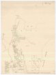
 Mapová sbírka Přírodovědecké fakulty UK v PrazeNarracan
 -
 Mapová sbírka Přírodovědecké fakulty UK v PrazeNarracan South
 -
 Mapová sbírka Přírodovědecké fakulty UK v PrazeNew Zealand
 -
 Mapová sbírka Přírodovědecké fakulty UK v PrazeNew Zealand
 -
 Mapová sbírka Přírodovědecké fakulty UK v PrazeNew Zealand
 -
 Mapová sbírka Přírodovědecké fakulty UK v PrazeNew Zealand
 -
 Mapová sbírka Přírodovědecké fakulty UK v PrazeParish of Bellender Ker, County of Nares
 -
 Mapová sbírka Přírodovědecké fakulty UK v PrazeParish of Danbulla, county of Nares