-
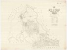
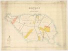
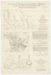
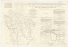
 Mapová sbírka Přírodovědecké fakulty UK v PrazeAdjie and portion of Welumla
 -
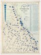
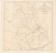
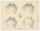
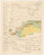
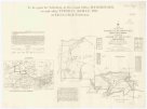
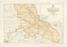
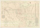
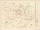
 Mapová sbírka Přírodovědecké fakulty UK v PrazeApproximate iso-potential lines of artesian pressure
 -
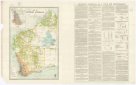
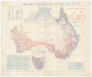
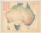 Mapová sbírka Přírodovědecké fakulty UK v PrazeAverage annual rainfall map of Australia
 -
 Mapová sbírka Přírodovědecké fakulty UK v PrazeAverage yearly temperature
 -
 Mapová sbírka Přírodovědecké fakulty UK v PrazeBinginwarri
 -
 Mapová sbírka Přírodovědecké fakulty UK v PrazeBudgerre
 -
 Mapová sbírka Přírodovědecké fakulty UK v PrazeColac Colac
 -
 Mapová sbírka Přírodovědecké fakulty UK v PrazeCook 2 mile map
 -
 Mapová sbírka Přírodovědecké fakulty UK v PrazeCook district 2 mile sketch map
 -
 Mapová sbírka Přírodovědecké fakulty UK v PrazeCopper mining district of Cloncurry, north western Queensland
 -
 Mapová sbírka Přírodovědecké fakulty UK v PrazeCounty of Clinton
 -
 Mapová sbírka Přírodovědecké fakulty UK v PrazeCounty of Livingstone
 -
 Mapová sbírka Přírodovědecké fakulty UK v PrazeCounty of Nares
 -
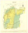
 Mapová sbírka Přírodovědecké fakulty UK v PrazeDevon
 -
 Mapová sbírka Přírodovědecké fakulty UK v PrazeEnvirons of Cairns
 -
 Mapová sbírka Přírodovědecké fakulty UK v PrazeGeneral plan of Brisbane River
 -
 Mapová sbírka Přírodovědecké fakulty UK v PrazeGeological map of Coolgardie
 -
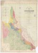
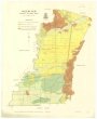
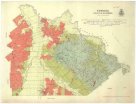
 Mapová sbírka Přírodovědecké fakulty UK v PrazeGeological map of Queensland
 -
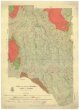
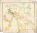
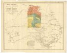
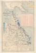
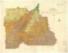
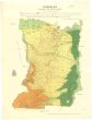
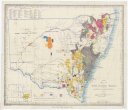
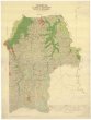
 Mapová sbírka Přírodovědecké fakulty UK v PrazeGeological map of South Australia
 -
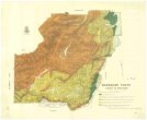
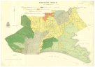
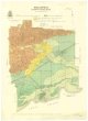
 Mapová sbírka Přírodovědecké fakulty UK v PrazeGeological map of portion of the Southern coal field
 -
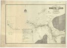 Mapová sbírka Přírodovědecké fakulty UK v PrazeGeological map of the North Lead Kanowna
 -
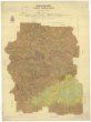
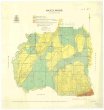
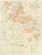
 Mapová sbírka Přírodovědecké fakulty UK v PrazeGeological map of the Northern Territory of South Australia
 -
 Mapová sbírka Přírodovědecké fakulty UK v PrazeGunyah Gunyah
 -
 Mapová sbírka Přírodovědecké fakulty UK v PrazeHazelwood
 -
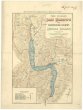
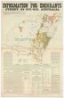 Mapová sbírka Přírodovědecké fakulty UK v PrazeInformation for emigrants to Sydney, New South Wales, Australia
 -
 Mapová sbírka Přírodovědecké fakulty UK v PrazeKennedy 2-mile map
 -
 Mapová sbírka Přírodovědecké fakulty UK v PrazeMap of Australia
 -
 Mapová sbírka Přírodovědecké fakulty UK v PrazeMap of M.t Kosciusko & surrounding districts
 -
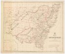 Mapová sbírka Přírodovědecké fakulty UK v PrazeMap of New South Wales
 -
 Mapová sbírka Přírodovědecké fakulty UK v PrazeMap of New Zealand
 -
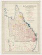
 Mapová sbírka Přírodovědecké fakulty UK v PrazeMap of Queensland
 -
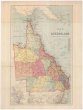
 Mapová sbírka Přírodovědecké fakulty UK v PrazeMap of Queensland
 -
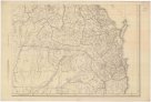
 Mapová sbírka Přírodovědecké fakulty UK v PrazeMap of Queensland
 -
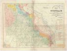
 Mapová sbírka Přírodovědecké fakulty UK v PrazeMap of Queensland
 -
 Mapová sbírka Přírodovědecké fakulty UK v PrazeMap of Queensland
 -
 Mapová sbírka Přírodovědecké fakulty UK v PrazeMap of Queensland showing annual rainfall to end of 1899
 -
 Mapová sbírka Přírodovědecké fakulty UK v PrazeMap of Queensland showing annual rainfall to end of 1906
 -
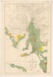
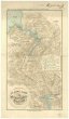
 Mapová sbírka Přírodovědecké fakulty UK v PrazeMap of Sydney harbour and surrounding districts, New South Wales
 -
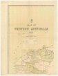 Mapová sbírka Přírodovědecké fakulty UK v PrazeMap of Western Australia
 -
 Mapová sbírka Přírodovědecké fakulty UK v PrazeMap of Western Australia, 1904
 -
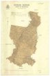
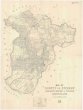 Mapová sbírka Přírodovědecké fakulty UK v PrazeMap of county of Fitzroy
 -
 Mapová sbírka Přírodovědecké fakulty UK v PrazeMap of east & west Moreton
 -
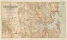
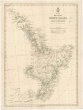 Mapová sbírka Přírodovědecké fakulty UK v PrazeMap of the North Island, New Zealand
 -
 Mapová sbírka Přírodovědecké fakulty UK v PrazeMap of the north eastern tourist district
 -
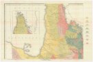
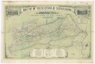
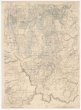
 Mapová sbírka Přírodovědecké fakulty UK v PrazeMap of the southern portion of South Australia
 -
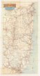
 Mapová sbírka Přírodovědecké fakulty UK v PrazeMap shewing the postal stations, mail roads & telegraph offices in New South Wales, 1898
 -
 Mapová sbírka Přírodovědecké fakulty UK v PrazeMaryvale
 -
 Mapová sbírka Přírodovědecké fakulty UK v PrazeMean monthly rainfall
 -
 Mapová sbírka Přírodovědecké fakulty UK v PrazeMean monthly temperature
 -
 Mapová sbírka Přírodovědecké fakulty UK v PrazeMeeniyan
 -
 Mapová sbírka Přírodovědecké fakulty UK v PrazeMirboo
 -
 Mapová sbírka Přírodovědecké fakulty UK v PrazeMoreton 2 mile map
 -
 Mapová sbírka Přírodovědecké fakulty UK v PrazeNarracan
 -
 Mapová sbírka Přírodovědecké fakulty UK v PrazeNarracan South
 -
 Mapová sbírka Přírodovědecké fakulty UK v PrazeNew Zealand
 -
 Mapová sbírka Přírodovědecké fakulty UK v PrazeNew Zealand
 -
 Mapová sbírka Přírodovědecké fakulty UK v PrazeNew Zealand
 -
 Mapová sbírka Přírodovědecké fakulty UK v PrazeNew Zealand
 -
 Mapová sbírka Přírodovědecké fakulty UK v PrazeParish of Bellender Ker, County of Nares
 -
 Mapová sbírka Přírodovědecké fakulty UK v PrazeParish of Danbulla, county of Nares
 -
 Mapová sbírka Přírodovědecké fakulty UK v PrazeParish of East Barron, County of Nares
 -
 Mapová sbírka Přírodovědecké fakulty UK v PrazeParish of Herberton, county of Cardwell
 -
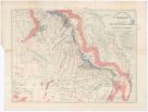
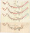
 Mapová sbírka Přírodovědecké fakulty UK v PrazePlan of River Murray between Morgan and province boundary
 -
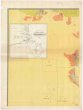
 Mapová sbírka Přírodovědecké fakulty UK v PrazePlan of country between River Murray and Pinnaroo railway
 -
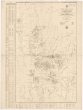
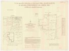
 Mapová sbírka Přírodovědecké fakulty UK v PrazePlan of portions 3 & 4 parish of Blairgowrie Charlotte Plains 1/4 resumption and portion 2 parish of Bellanda Telemon 1/4 resumption, county of Dutton
 -
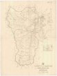
 Mapová sbírka Přírodovědecké fakulty UK v PrazePlan of portions 5 & 6 parish of Malden, county of Beaufort
 -
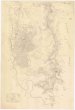
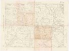
 Mapová sbírka Přírodovědecké fakulty UK v PrazePlan of portions 8 to 11 parish of Avington, Avington resumption, county of Youranigh
 -
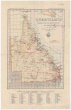 Mapová sbírka Přírodovědecké fakulty UK v PrazeQueensland
 -
 Mapová sbírka Přírodovědecké fakulty UK v PrazeQueensland four mile maps
 -
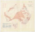
 Mapová sbírka Přírodovědecké fakulty UK v PrazeRain map of Australia for the year 1909
 -
 Mapová sbírka Přírodovědecké fakulty UK v PrazeRain map of Australia for the year 1922
 -
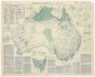
 Mapová sbírka Přírodovědecké fakulty UK v PrazeRainfall of Australia
 -
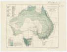 Mapová sbírka Přírodovědecké fakulty UK v PrazeRevised average annual rainfall map
 -
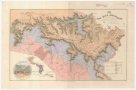
 Mapová sbírka Přírodovědecké fakulty UK v PrazeSavaii
 -
 Mapová sbírka Přírodovědecké fakulty UK v PrazeSketch map of Cape York peninsula
 -
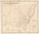
 Mapová sbírka Přírodovědecké fakulty UK v PrazeSketch map of New South Wales showing the localities of the principal minerals
 -
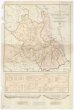
 Mapová sbírka Přírodovědecké fakulty UK v PrazeSketch map of east central Queensland
 -
 Mapová sbírka Přírodovědecké fakulty UK v PrazeSketch map of goldfields in the vicinity of Charters Towers
 -
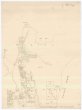
 Mapová sbírka Přírodovědecké fakulty UK v PrazeSketch map of portions 57 & 58 parish of Tinaroo, county of Nares
 -
 Mapová sbírka Přírodovědecké fakulty UK v PrazeSketch map of portions 6 to 13 & 15 to 32 parish of Greenup, portions 8 to 11 parish of Plassey and portions 174 to 177 parish of Coolmunda countries of Clive & Bentinck
 -
 Mapová sbírka Přírodovědecké fakulty UK v PrazeSketch map of the Croydon & Etheridge goldfields
 -
 Mapová sbírka Přírodovědecké fakulty UK v PrazeSketch map of the Etheridge goldfield
 -
 Mapová sbírka Přírodovědecké fakulty UK v PrazeSketch map shewing rabbit board districts and rabbit proof fence, Queensland
 -
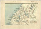
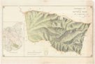
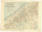 Mapová sbírka Přírodovědecké fakulty UK v PrazeSouth Westland and central portion of Southern Alps
 -
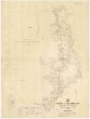
 Mapová sbírka Přírodovědecké fakulty UK v PrazeTarwin South
 -
 Mapová sbírka Přírodovědecké fakulty UK v PrazeThe Blue Mountains
 -
 Mapová sbírka Přírodovědecké fakulty UK v PrazeThe catchment areas of the Brisbane River and of the Logan and Albert Rivers &c.
 -
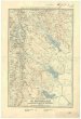
 Mapová sbírka Přírodovědecké fakulty UK v PrazeThowgla and part of Kangobin
 -
 Mapová sbírka Přírodovědecké fakulty UK v PrazeTopographical map of Hills district between Adelaide & the Bremer Ranges
 -
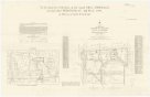
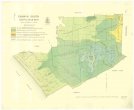
 Mapová sbírka Přírodovědecké fakulty UK v PrazeTopographical plan of the National Park Hd. of Adelaide
 -
 Mapová sbírka Přírodovědecké fakulty UK v PrazeTourists sketch map
 -
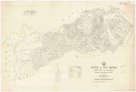
 Mapová sbírka Přírodovědecké fakulty UK v PrazeTowong
 -
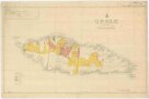 Mapová sbírka Přírodovědecké fakulty UK v PrazeUpolu
 -
 Mapová sbírka Přírodovědecké fakulty UK v PrazeWaratah North
 -
 Mapová sbírka Přírodovědecké fakulty UK v PrazeWelshpool
 -
 Mapová sbírka Přírodovědecké fakulty UK v PrazeWide Bay