-
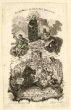
 Slezské zemské muzeumKorunování Panny Marie
 -
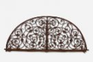 Slezské zemské muzeumKovaná mříž lunetového nadsvětlíku
 -
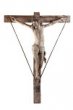 Slezské zemské muzeumKrucifix
 -
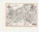
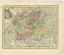
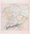
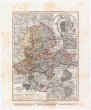
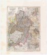 Mapová sbírka Přírodovědecké fakulty UK v PrazeKurfürstenthum HESSEN
 -
 Slezské zemské muzeumLaudate Dominum
 -
 Slezské zemské muzeumLaudate Pueri
 -
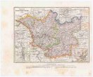
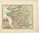
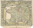 Mapová sbírka Přírodovědecké fakulty UK v PrazeLe royaume de France et les conquetes de Louis de Grand
 -
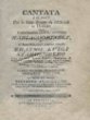 Slezské zemské muzeumLibreto svatební kantáty
 -
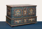 Slezské zemské muzeumLidová malovaná truhla
 -
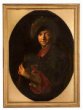 Slezské zemské muzeumLoutnista
 -
 Slezské zemské muzeumLáhev na čaj s reliéfními portréty císaře Karla VI. a císařovny Alžběty Kristýny
 -
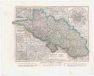
 Mapová sbírka Přírodovědecké fakulty UK v PrazeMECKLENBURG
 -
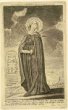
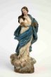 Slezské zemské muzeumMadona
 -
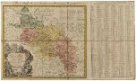
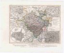
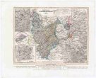
 Mapová sbírka Přírodovědecké fakulty UK v PrazeMapa W. Ks. Poznańskiego
 -
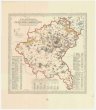
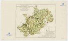
 Slezské zemské muzeumMapa území vratislavské diecéze.
 -
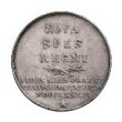
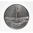
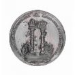
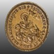
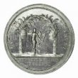 Slezské zemské muzeumMedaile
 -
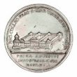
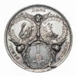
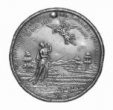
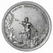 Slezské zemské muzeumMedaile
 -
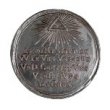
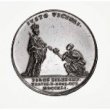
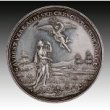
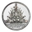 Slezské zemské muzeumMedaile
 -
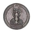
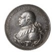
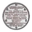 Slezské zemské muzeumMedaile
 -
 Slezské zemské muzeumMedaile
 -
 Slezské zemské muzeumMedaile
 -
 Slezské zemské muzeumMedaile
 -
 Slezské zemské muzeumMedaile
 -
 Slezské zemské muzeumMedaile
 -
 Slezské zemské muzeumMedaile
 -
 Slezské zemské muzeumMedaile
 -
 Slezské zemské muzeumMedaile
 -
 Slezské zemské muzeumMedaile
 -
 Slezské zemské muzeumMedaile
 -
 Slezské zemské muzeumMedaile
 -
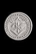
 Slezské zemské muzeumMedaile
 -
 Slezské zemské muzeumMystické zasnoubení sv. Kateřiny Sienské
 -
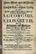 Slezské zemské muzeumMüller, Willibald: Sonn Mond und eilff Sternn
 -
 Slezské zemské muzeumNegativ skleněný - fotokopie arch. mater
 -
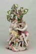 Slezské zemské muzeumNeptun a Amphitrite
 -
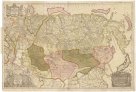 Mapová sbírka Přírodovědecké fakulty UK v PrazeNova descriptio geographica Tattariae magnae tam orientalis quam occidentalis in particularibus et generalibus territoriis una cum delineatione totius imperii Russici imprimis Siberiae accurate ostensa
 -
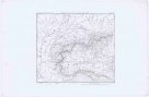
 Mapová sbírka Přírodovědecké fakulty UK v PrazeNovissima Foederatorum HELVETIORUM Tabula
 -
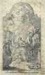 Slezské zemské muzeumNáčrt oltářního obrazu
 -
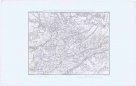
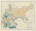
 Mapová sbírka Přírodovědecké fakulty UK v PrazeObjektive Karte der Bevölkerungsvertheilung in Oberfranken
 -
 Slezské zemské muzeumOdlitek pečeti cechu tesařů v Krnově
 -
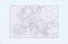
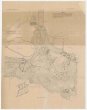
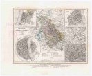
Mapová sbírka Přírodovědecké fakulty UK v PrazeOesterreichisch-russisch-türkischer Kriegsatlas
-
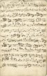
 Slezské zemské muzeumOffertorium in C
 -
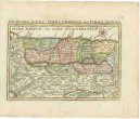
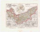
 Mapová sbírka Přírodovědecké fakulty UK v PrazeOriginalkarte der Insel Korfu
 -
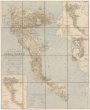
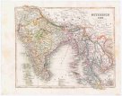 Mapová sbírka Přírodovědecké fakulty UK v PrazeOstindien
 -
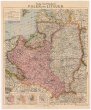
 Mapová sbírka Přírodovědecké fakulty UK v PrazePALAESTINA IUDAEA, TERRA PROMISSA aut TERRA SANCTA
 -
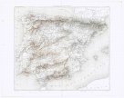
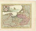
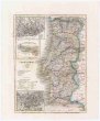 Mapová sbírka Přírodovědecké fakulty UK v PrazePORTUGAL und die AZOREN
 -
 Slezské zemské muzeumPanna Marie Sedmibolestná Cvilínská
 -
 Slezské zemské muzeumPečetidlo formálního studia při opavském klášteře bratří kazatelů (dominikánů)
 -
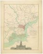 Mapová sbírka Přírodovědecké fakulty UK v PrazePlan of the city and environs of Philadelphia
 -
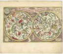 Mapová sbírka Přírodovědecké fakulty UK v PrazePlaniglobium coeleste
 -
 Mapová sbírka Přírodovědecké fakulty UK v PrazePlans et cartes pour l'histoire du consulat et de l'empire
 -
 Mapová sbírka Přírodovědecké fakulty UK v PrazePlans et cartes pour l'histoire du consulat et de l'empire
 -
 Mapová sbírka Přírodovědecké fakulty UK v PrazePlans et cartes pour l'histoire du consulat et de l'empire
 -
 Mapová sbírka Přírodovědecké fakulty UK v PrazePlans et cartes pour l'histoire du consulat et de l'empire
 -
 Mapová sbírka Přírodovědecké fakulty UK v PrazePlans et cartes pour l'histoire du consulat et de l'empire
 -
 Mapová sbírka Přírodovědecké fakulty UK v PrazePlans et cartes pour l'histoire du consulat et de l'empire
 -
 Mapová sbírka Přírodovědecké fakulty UK v PrazePlans et cartes pour l'histoire du consulat et de l'empire
 -
 Mapová sbírka Přírodovědecké fakulty UK v PrazePlans et cartes pour l'histoire du consulat et de l'empire
 -
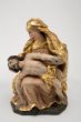 Slezské zemské muzeumPlastika - Pieta
 -
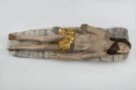 Slezské zemské muzeumPlastika - Tělo Ježíše Krista z Božího hrobu
 -
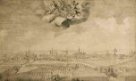
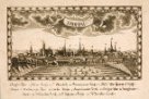 Slezské zemské muzeumPohled na Opavu
 -
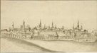 Slezské zemské muzeumPohled na Opavu od jihozápadu
 -
 Slezské zemské muzeumPohled na Opavu od severovýchodu
 -
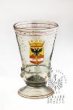 Slezské zemské muzeumPohár se znakem města Terst
 -
 Mapová sbírka Přírodovědecké fakulty UK v PrazePolen und Litauen
 -
 Mapová sbírka Přírodovědecké fakulty UK v PrazePolen vom Anfange des XVIII Jahrhunderts bis zum Untergange der Republik 1795
 -
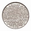
 Slezské zemské muzeumPortrét císaře Leopolda II.
 -
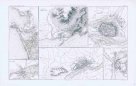
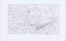
 Mapová sbírka Přírodovědecké fakulty UK v PrazePosition der k. k. oesterreichischen sowohl Belagerungs-als Observations-Armee, wie selbe unter Comando des Feldmarschaln Freyhern von Laudohn von 15ten 7bris bis 7ten 8bris 1789 vor der Festung Belgrad gestanden, an welchen Tag die Festung mit Capitulation übergeben wurde.
 -
 Mapová sbírka Přírodovědecké fakulty UK v PrazeProvinz Brandenburg
 -
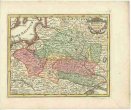
 Mapová sbírka Přírodovědecké fakulty UK v PrazeProvinz Pommern
 -
 Mapová sbírka Přírodovědecké fakulty UK v PrazeProvinz Posen
 -
 Mapová sbírka Přírodovědecké fakulty UK v PrazeProvinz Sachsen
 -
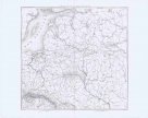
 Mapová sbírka Přírodovědecké fakulty UK v PrazeProvinz Schlesien
 -
 Mapová sbírka Přírodovědecké fakulty UK v PrazeProvinz West-Preussen
 -
 Mapová sbírka Přírodovědecké fakulty UK v PrazeProvinz Westphalen
 -
 Mapová sbírka Přírodovědecké fakulty UK v PrazeREGNI PRUSSIAE accurata delineatio
 -
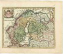
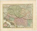 Mapová sbírka Přírodovědecké fakulty UK v PrazeREGNUM HUNGARIAE cum contiguis regionibus
 -
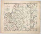
 Mapová sbírka Přírodovědecké fakulty UK v PrazeREGNUM POLONIAE ejusque confinia
 -
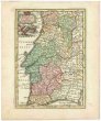 Mapová sbírka Přírodovědecké fakulty UK v PrazeREGNUM PORTUGALLIAE et ALGARBIAE
 -
 Mapová sbírka Přírodovědecké fakulty UK v PrazeRegenkarte von Deutschland
 -
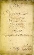 Slezské zemské muzeumRegina Coeli del Signore Antonio Albrechtrsberger
 -
 Slezské zemské muzeumRegina Coeli del Signore Antonio Albrechtrsberger
 -
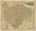 Mapová sbírka Přírodovědecké fakulty UK v PrazeRegni Bohemiae
 -
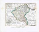
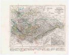
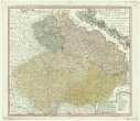 Mapová sbírka Přírodovědecké fakulty UK v PrazeRegni Bohemiae, Dvc. Silesiae, Marchionatvvm Moraviae et Lvsatiae Tabula generalis
 -
 Mapová sbírka Přírodovědecké fakulty UK v PrazeRegnum Galliae moderna
 -
 Mapová sbírka Přírodovědecké fakulty UK v PrazeRheinprovinz Jülich-Cleve-Berg
 -
 Mapová sbírka Přírodovědecké fakulty UK v PrazeRheinprovinz Niederrhein
 -
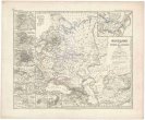 Mapová sbírka Přírodovědecké fakulty UK v PrazeRussland seit Peters des Grossen Zeit
 -
 Mapová sbírka Přírodovědecké fakulty UK v PrazeSACHSEN
 -
 Mapová sbírka Přírodovědecké fakulty UK v PrazeSUECIAE Regnum cum vicinis Regionibus
 -
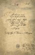
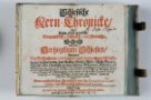 Slezské zemské muzeumSchlesische Kern-Chronicke
 -
 Slezské zemské muzeumSchlesischer Curiositäten
 -
 Slezské zemské muzeumSedmibolestná Panna Maria z Cvilína u Krnova
 -
 Slezské zemské muzeumSedmibolestná Panna Maria z Cvilína u Krnova
 -
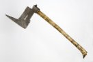 Slezské zemské muzeumSekyrka hornická
 -
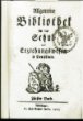
 Slezské zemské muzeumSilesiographia renovata, Necessariis Scholiis, Observationibus et indice aucta